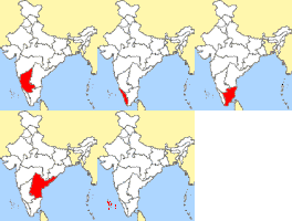
Animated sequence showing a map of India with red-highlighted regions changing across frames, set against yellow landmass and blue water background.

Permanent icon record

Animated sequence showing a map of India with red-highlighted regions changing across frames, set against yellow landmass and blue water background.

Animated sequence showing a map of India with red-highlighted regions changing across frames, set against yellow landmass and blue water background. Animated 88×100 GIF AIM buddy…

A visual description has not been added yet. The archival record below is still available.

Download original

About this icon

Animation

  • changes showing red region movement and transformation

Animation Summary

The red highlighted region on the map of India changes shape and position across six , starting as a small area in Kerala (frame 0), expanding eastward into Tamil Nadu (frame 2), covering most southern states by frame 3, then shrinking to two dots near the coast in frame 5 before消失

Composition

  • central landmass with water on three sides
  • consistent framing across all frames

Dense Caption

The animation consists of six sequential frames depicting a stylized map of India. The map features white administrative boundaries on a yellow landmass with light blue water bodies representing the Indian Ocean and Bay of Bengal. In frame 0, a red region appears in the southwest (Kerala). Frame 1 shows the red area shifting slightly northward within Kerala. Frame 2 displays the red region expanding eastward into Tamil Nadu. Frame 3 reveals the red area covering most of southern India including Karnataka and Andhra Pradesh. Frame 4 has the red region shrinking to a smaller shape in central-south India. Frame 5 shows the red region disappearing entirely, leaving only two small red dots near the southern coast. The map maintains consistent white borders between states throughout all frames.

Description

Animated sequence showing a map of India with red-highlighted regions changing across frames, set against yellow landmass and blue water background.

Metadata Not Confirmed By Image

  • collection identity (query-selected; hint): south-park
  • observation category (query-selected): gifcities
  • provenance era: 1999
  • provenance era: 2009
  • provenance source-name: GifCities South Park Avatar Small Mixed-Size Search
  • provenance source-name: GifCities South Park Icon Small Mixed-Size Search
  • provenance topic-coverage: AIM profiles
  • provenance collection-attribute: avatar
  • provenance topic-coverage: avatars
  • provenance collection-attribute: cartoon
  • provenance topic-coverage: cartoons
  • provenance collection-attribute: fan
  • provenance topic-coverage: fan pages

Metadata Only Entities

  • south-park
  • gifcities
  • aim profiles
  • avatars
  • cartoons
  • fan pages

Non Redundant Search Phrases

  • map of india red regions animation
  • india map changing highlighted areas
  • indiana map animation
  • red region movement on indian map

Preprocessing Notes

  • quarantined animationSummary: The red highlighted region on the map of India changes shape and position across six sequential frames, starting as a small area in Kerala (frame 0), expanding eastward into Tamil Nadu (frame 2), covering most southern states by frame 3, then shrinking to two dots near the coast in frame 5 before消失.
  • quarantined wordwall: six sequential frames
  • quarantined animation: sequential frame changes showing red region movement and transformation
  • quarantined retrieval: six frame indiana map animation

Visually Supported Entities

  • india

Wordwall

  • map of india
  • yellow landmass
  • light blue water
  • red highlighted regions
  • white administrative boundaries
  • six

Source & archive date

Added to archive
July 10, 2026

GifCities South Park Icon Small Mixed-Size Search

Source title
GifCities
Category
search / gifcities
Era
GeoCities South Park Fan Icon Cross-Section
Observed
July 10, 2026 at 00:48 UTC

GifCities South Park Avatar Small Mixed-Size Search

Source title
GifCities
Category
search / gifcities
Era
GeoCities Fandom Avatar Cross-Section
Observed
July 10, 2026 at 06:00 UTC
Technical archive details
Format
GIF
Dimensions
88×100 pixels
File size
8 KB
Motion
Animated (5 frames)
Added to archive
July 10, 2026
Relative path
icons/40/40c06815931b7da78f1f66bc54a18b70e07d3284f34dc877394a831d21a42245.gif
Media type
image/gif
Scanner metadata
v1
Animation inspected
July 10, 2026 at 00:48 UTC
Archive ID
40c06815931b7da7
SHA-256
40c06815931b7da78f1f66bc54a18b70e07d3284f34dc877394a831d21a42245
Content-safety assessments (1)
onnxOwenElliott/image-safety-classifier-sbroad
Assessed
July 23, 2026 at 07:51 UTC
Run
107
Input
image
Preprocessing
four-even-frames;flatten-rgb192;stretch-224;triangle;nchw-rgb-u8
Overall label
sfw
Overall score
0.075412

OpenAI category scores

CategoryScoreProvider flagonnx/sfw0.929970onnx/unsafe0.075412onnx/nsfl0.041057onnx/nsfw0.034355
Enrichment records (2)
wordwall-v1qwen3-vl:30bcontact-sheet-smartok

Animated sequence showing a map of India with red-highlighted regions changing across frames, set against yellow landmass and blue water background.

Reviewed
July 26, 2026 at 02:33 UTC
Run
50
Version
v5
Elapsed
15,646 ms
Tokens
prompt 2,128, response 818

Review tags

  • red region expands eastward in frame 2 (action, 0.80)
  • red region shrinks to two dots in frame 5 (action, 0.80)
  • light blue (color, 0.80)
  • red (color, 0.80)
  • white (color, 0.80)
  • yellow (color, 0.80)
  • administrative boundaries (object, 0.80)
  • water bodies (object, 0.80)
  • simplified geographic representation (style, 0.80)
  • stylized map (style, 0.80)
  • map of india (subject, 0.80)

Actions

  • red region changes shape and position across frames
  • red region expands eastward in frame 2
  • red region shrinks to two dots in frame 5

Animation

  • changes showing red region movement and transformation

Animation Summary

The red highlighted region on the map of India changes shape and position across six , starting as a small area in Kerala (frame 0), expanding eastward into Tamil Nadu (frame 2), covering most southern states by frame 3, then shrinking to two dots near the coast in frame 5 before消失

Colors

  • yellow
  • light blue
  • white
  • red

Composition

  • central landmass with water on three sides
  • consistent framing across all frames

Dense Caption

The animation consists of six sequential frames depicting a stylized map of India. The map features white administrative boundaries on a yellow landmass with light blue water bodies representing the Indian Ocean and Bay of Bengal. In frame 0, a red region appears in the southwest (Kerala). Frame 1 shows the red area shifting slightly northward within Kerala. Frame 2 displays the red region expanding eastward into Tamil Nadu. Frame 3 reveals the red area covering most of southern India including Karnataka and Andhra Pradesh. Frame 4 has the red region shrinking to a smaller shape in central-south India. Frame 5 shows the red region disappearing entirely, leaving only two small red dots near the southern coast. The map maintains consistent white borders between states throughout all frames.

Description

Animated sequence showing a map of India with red-highlighted regions changing across frames, set against yellow landmass and blue water background.

Metadata Not Confirmed By Image

  • collection identity (query-selected; hint): south-park
  • observation category (query-selected): gifcities
  • provenance era: 1999
  • provenance era: 2009
  • provenance source-name: GifCities South Park Avatar Small Mixed-Size Search
  • provenance source-name: GifCities South Park Icon Small Mixed-Size Search
  • provenance topic-coverage: AIM profiles
  • provenance collection-attribute: avatar
  • provenance topic-coverage: avatars
  • provenance collection-attribute: cartoon
  • provenance topic-coverage: cartoons
  • provenance collection-attribute: fan
  • provenance topic-coverage: fan pages

Metadata Only Entities

  • south-park
  • gifcities
  • aim profiles
  • avatars
  • cartoons
  • fan pages

Non Redundant Search Phrases

  • map of india red regions animation
  • india map changing highlighted areas
  • indiana map animation
  • red region movement on indian map

Objects

  • administrative boundaries
  • water bodies

Preprocessing Notes

  • quarantined animationSummary: The red highlighted region on the map of India changes shape and position across six sequential frames, starting as a small area in Kerala (frame 0), expanding eastward into Tamil Nadu (frame 2), covering most southern states by frame 3, then shrinking to two dots near the coast in frame 5 before消失.
  • quarantined wordwall: six sequential frames
  • quarantined animation: sequential frame changes showing red region movement and transformation
  • quarantined retrieval: six frame indiana map animation

Style

  • stylized map
  • simplified geographic representation

Subjects

  • map of india

Visually Supported Entities

  • india

Wordwall

  • map of india
  • yellow landmass
  • light blue water
  • red highlighted regions
  • white administrative boundaries
  • six
Raw JSON
{
  "inputIndex": 0,
  "sha256": "40c06815931b7da78f1f66bc54a18b70e07d3284f34dc877394a831d21a42245",
  "description": "Animated sequence showing a map of India with red-highlighted regions changing across frames, set against yellow landmass and blue water background.",
  "denseCaption": "The animation consists of six sequential frames depicting a stylized map of India. The map features white administrative boundaries on a yellow landmass with light blue water bodies representing the Indian Ocean and Bay of Bengal. In frame 0, a red region appears in the southwest (Kerala). Frame 1 shows the red area shifting slightly northward within Kerala. Frame 2 displays the red region expanding eastward into Tamil Nadu. Frame 3 reveals the red area covering most of southern India including Karnataka and Andhra Pradesh. Frame 4 has the red region shrinking to a smaller shape in central-south India. Frame 5 shows the red region disappearing entirely, leaving only two small red dots near the southern coast. The map maintains consistent white borders between states throughout all frames.",
  "wordwall": [
    "map of india",
    "yellow landmass",
    "light blue water",
    "red highlighted regions",
    "white administrative boundaries",
    "six"
  ],
  "visibleText": [],
  "uncertainText": [],
  "subjects": [
    "map of india"
  ],
  "actions": [
    "red region changes shape and position across frames",
    "red region expands eastward in frame 2",
    "red region shrinks to two dots in frame 5"
  ],
  "objects": [
    "administrative boundaries",
    "water bodies"
  ],
  "colors": [
    "yellow",
    "light blue",
    "white",
    "red"
  ],
  "style": [
    "stylized map",
    "simplified geographic representation"
  ],
  "composition": [
    "central landmass with water on three sides",
    "consistent framing across all frames"
  ],
  "mood": [],
  "animation": [
    "changes showing red region movement and transformation"
  ],
  "preprocessingNotes": [
    "quarantined animationSummary: The red highlighted region on the map of India changes shape and position across six sequential frames, starting as a small area in Kerala (frame 0), expanding eastward into Tamil Nadu (frame 2), covering most southern states by frame 3, then shrinking to two dots near the coast in frame 5 before\u6D88\u5931.",
    "quarantined wordwall: six sequential frames",
    "quarantined animation: sequential frame changes showing red region movement and transformation",
    "quarantined retrieval: six frame indiana map animation"
  ],
  "sourceMetadataInterpretation": [],
  "metadataSupportedByImage": [],
  "metadataNotConfirmedByImage": [
    "collection identity (query-selected; hint): south-park",
    "observation category (query-selected): gifcities",
    "provenance era: 1999",
    "provenance era: 2009",
    "provenance source-name: GifCities South Park Avatar Small Mixed-Size Search",
    "provenance source-name: GifCities South Park Icon Small Mixed-Size Search",
    "provenance topic-coverage: AIM profiles",
    "provenance collection-attribute: avatar",
    "provenance topic-coverage: avatars",
    "provenance collection-attribute: cartoon",
    "provenance topic-coverage: cartoons",
    "provenance collection-attribute: fan",
    "provenance topic-coverage: fan pages"
  ],
  "metadataContradictedByImage": [],
  "visuallySupportedEntities": [
    "india"
  ],
  "metadataOnlyEntities": [
    "south-park",
    "gifcities",
    "aim profiles",
    "avatars",
    "cartoons",
    "fan pages"
  ],
  "identityHypotheses": [],
  "namedEntities": [],
  "fandoms": [],
  "animationSummary": "The red highlighted region on the map of India changes shape and position across six , starting as a small area in Kerala (frame 0), expanding eastward into Tamil Nadu (frame 2), covering most southern states by frame 3, then shrinking to two dots near the coast in frame 5 before\u6D88\u5931",
  "nonRedundantSearchPhrases": [
    "map of india red regions animation",
    "india map changing highlighted areas",
    "indiana map animation",
    "red region movement on indian map"
  ],
  "uncertainty": [],
  "aestheticStrengths": [],
  "aestheticWeaknesses": [],
  "tags": [
    {
      "tag": "map of india",
      "category": "subject",
      "confidence": 0.8,
      "evidence": "visible: map of india"
    },
    {
      "tag": "red region expands eastward in frame 2",
      "category": "action",
      "confidence": 0.8,
      "evidence": "visible: red region expands eastward in frame 2"
    },
    {
      "tag": "red region shrinks to two dots in frame 5",
      "category": "action",
      "confidence": 0.8,
      "evidence": "visible: red region shrinks to two dots in frame 5"
    },
    {
      "tag": "administrative boundaries",
      "category": "object",
      "confidence": 0.8,
      "evidence": "visible: administrative boundaries"
    },
    {
      "tag": "water bodies",
      "category": "object",
      "confidence": 0.8,
      "evidence": "visible: water bodies"
    },
    {
      "tag": "stylized map",
      "category": "style",
      "confidence": 0.8,
      "evidence": "visible: stylized map"
    },
    {
      "tag": "simplified geographic representation",
      "category": "style",
      "confidence": 0.8,
      "evidence": "visible: simplified geographic representation"
    },
    {
      "tag": "yellow",
      "category": "color",
      "confidence": 0.8,
      "evidence": "visible: yellow"
    },
    {
      "tag": "light blue",
      "category": "color",
      "confidence": 0.8,
      "evidence": "visible: light blue"
    },
    {
      "tag": "white",
      "category": "color",
      "confidence": 0.8,
      "evidence": "visible: white"
    },
    {
      "tag": "red",
      "category": "color",
      "confidence": 0.8,
      "evidence": "visible: red"
    }
  ],
  "rawModelResponse": {
    "icons": [
      {
        "inputIndex": 0,
        "sha256": "40c06815931b7da78f1f66bc54a18b70e07d3284f34dc877394a831d21a42245",
        "description": "Animated sequence showing a map of India with red-highlighted regions changing across frames, set against yellow landmass and blue water background.",
        "denseCaption": "The animation consists of six sequential frames depicting a stylized map of India. The map features white administrative boundaries on a yellow landmass with light blue water bodies representing the Indian Ocean and Bay of Bengal. In frame 0, a red region appears in the southwest (Kerala). Frame 1 shows the red area shifting slightly northward within Kerala. Frame 2 displays the red region expanding eastward into Tamil Nadu. Frame 3 reveals the red area covering most of southern India including Karnataka and Andhra Pradesh. Frame 4 has the red region shrinking to a smaller shape in central-south India. Frame 5 shows the red region disappearing entirely, leaving only two small red dots near the southern coast. The map maintains consistent white borders between states throughout all frames.",
        "wordwall": [
          "map of india",
          "yellow landmass",
          "light blue water",
          "red highlighted regions",
          "white administrative boundaries",
          "six sequential frames"
        ],
        "visibleText": [],
        "uncertainText": [],
        "subjects": [
          "map of india"
        ],
        "actions": [
          "red region changes shape and position across frames",
          "red region expands eastward in frame 2",
          "red region shrinks to two dots in frame 5"
        ],
        "objects": [
          "administrative boundaries",
          "water bodies"
        ],
        "colors": [
          "yellow",
          "light blue",
          "white",
          "red"
        ],
        "style": [
          "stylized map",
          "simplified geographic representation"
        ],
        "composition": [
          "central landmass with water on three sides",
          "consistent framing across all frames"
        ],
        "mood": [],
        "animation": [
          "sequential frame changes showing red region movement and transformation"
        ],
        "preprocessingNotes": [],
        "sourceMetadataInterpretation": [],
        "metadataSupportedByImage": [],
        "metadataNotConfirmedByImage": [
          "collection identity (query-selected; hint): south-park",
          "observation category (query-selected): gifcities",
          "provenance era: 1999",
          "provenance era: 2009",
          "provenance source-name: GifCities South Park Avatar Small Mixed-Size Search",
          "provenance source-name: GifCities South Park Icon Small Mixed-Size Search",
          "provenance topic-coverage: AIM profiles",
          "provenance collection-attribute: avatar",
          "provenance topic-coverage: avatars",
          "provenance collection-attribute: cartoon",
          "provenance topic-coverage: cartoons",
          "provenance collection-attribute: fan",
          "provenance topic-coverage: fan pages"
        ],
        "metadataContradictedByImage": [],
        "visuallySupportedEntities": [
          "india"
        ],
        "metadataOnlyEntities": [
          "south-park",
          "gifcities",
          "aim profiles",
          "avatars",
          "cartoons",
          "fan pages"
        ],
        "identityHypotheses": [],
        "namedEntities": [],
        "fandoms": [],
        "animationSummary": "The red highlighted region on the map of India changes shape and position across six sequential frames, starting as a small area in Kerala (frame 0), expanding eastward into Tamil Nadu (frame 2), covering most southern states by frame 3, then shrinking to two dots near the coast in frame 5 before\u6D88\u5931.",
        "nonRedundantSearchPhrases": [
          "map of india red regions animation",
          "india map changing highlighted areas",
          "six frame indiana map animation",
          "red region movement on indian map"
        ],
        "tags": []
      }
    ]
  }
}
wordwall-v1qwen3-vl:30bcontact-sheet-smarterror
Reviewed
July 14, 2026 at 01:37 UTC
Run
30
Version
v3
Elapsed
0 ms
Error
No connection could be made because the target machine actively refused it. (127.0.0.1:11435)
Raw JSON
Full source records (2)

GifCities South Park Icon Small Mixed-Size Search (gifcities-south-park-icon-small-mixed)

Kind
static-gallery
Era
GeoCities South Park Fan Icon Cross-Section
Type
Internet Archive GifCities search result
Category
search / gifcities
Title
GifCities
Observed
July 10, 2026 at 00:48 UTC
Rights
mixed GeoCities user/fan material; research/reference only by default
Slice
search-selected small and near-square GeoCities South Park icon candidates

GifCities South Park Avatar Small Mixed-Size Search (gifcities-south-park-avatar-small-mixed)

Kind
static-gallery
Era
GeoCities Fandom Avatar Cross-Section
Type
Internet Archive GifCities search result
Category
search / gifcities
Title
GifCities
Observed
July 10, 2026 at 06:00 UTC
Rights
mixed GeoCities user material; research/reference only by default
Slice
search-selected small and near-square South Park avatar candidates from GeoCities fan pages